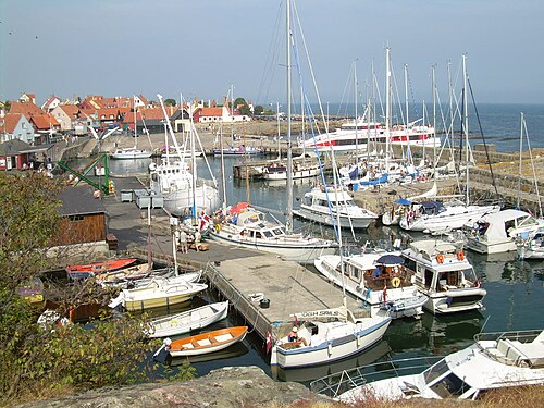
🇩🇰 Weather in Gudhjem in April
This is what the weather in Gudhjem (Bornholm, Denmark) was like in April in 2017–2026.
Key facts at a glance
Avg. daytime high
7.1 °C
5.9 °C – 8.6 °C
Avg. night-time low
4.9 °C
4.0 °C – 6.1 °C
Avg. rain days in period
5.7
19 % of days · ≥ 1.0 mm
Avg. precipitation in period
36.0 mm
5.9 mm – 82.1 mm
Avg. cloud cover
60 %
This data source has no sunshine hours – average cloud cover shown instead.
Avg. sea temperature
–
Sea temperature unavailable for today (daily limit).
Extremes: Highest temperature 13.4 °C (17 Apr 2025) · Lowest temperature 1.0 °C (2 Apr 2018) · Avg. daily peak wind 31 km/h
Weather mix of all days
- 44Sunny
- 132Partly cloudy
- 67Cloudy
- 33Light rain
- 24Rain
Summary
- On average 7.1 °C during the day and 4.9 °C at night.
- On average 5.7 rain days (Rain day = at least 1.0 mm of precipitation) with 36.0 mm of precipitation in total.
- Prevailing: Partly cloudy.
- Warmest year: 2025 (avg. 8.6 °C), coolest: 2021 (avg. 5.9 °C).
- Wettest year: 2024 (82.1 mm), driest: 2025 (5.9 mm).
- Extremes: 13.4 °C on 17 Apr 2025 and 1.0 °C on 2 Apr 2018.
Overall values from all 10 years. How is this calculated?
Charts
Temperatures per year
Average over your travel period
Precipitation & rain days
Year by year
2026
Avg. max6.8°Avg. min4.4°- Rain days
- 4 Rain days
- Precipitation
- 19.9 mm
- Avg. cloud cover
- 49 % cloudy
- Sea temperature
- –
Max 10.8 °C · Min 2.2 °C
2025
Avg. max8.6°Avg. min6.0°- Rain days
- 1 Rain days
- Precipitation
- 5.9 mm
- Avg. cloud cover
- 60 % cloudy
- Sea temperature
- –
Max 13.4 °C · Min 2.7 °C
2024
Avg. max7.1°Avg. min4.9°- Rain days
- 13 Rain days
- Precipitation
- 82.1 mm
- Avg. cloud cover
- 77 % cloudy
- Sea temperature
- –
Max 11.3 °C · Min 1.2 °C
2023
Avg. max6.1°Avg. min4.3°- Rain days
- 8 Rain days
- Precipitation
- 43.8 mm
- Avg. cloud cover
- 57 % cloudy
- Sea temperature
- –
Max 9.0 °C · Min 1.7 °C
2022
Avg. max6.5°Avg. min4.5°- Rain days
- 6 Rain days
- Precipitation
- 48.6 mm
- Avg. cloud cover
- 60 % cloudy
- Sea temperature
- –
Max 9.5 °C · Min 2.0 °C
2021
Avg. max5.9°Avg. min4.0°- Rain days
- 6 Rain days
- Precipitation
- 42.0 mm
- Avg. cloud cover
- 63 % cloudy
- Sea temperature
- –
Max 8.9 °C · Min 2.3 °C
2020
Avg. max8.4°Avg. min6.1°- Rain days
- 4 Rain days
- Precipitation
- 14.5 mm
- Avg. cloud cover
- 57 % cloudy
- Sea temperature
- –
Max 11.1 °C · Min 3.9 °C
2019
Avg. max7.6°Avg. min5.3°- Rain days
- 2 Rain days
- Precipitation
- 15.4 mm
- Avg. cloud cover
- 49 % cloudy
- Sea temperature
- –
Max 12.0 °C · Min 2.1 °C
2018
Avg. max7.3°Avg. min4.6°- Rain days
- 5 Rain days
- Precipitation
- 47.3 mm
- Avg. cloud cover
- 63 % cloudy
- Sea temperature
- –
Max 11.5 °C · Min 1.0 °C
2017
Avg. max6.3°Avg. min4.5°- Rain days
- 8 Rain days
- Precipitation
- 40.2 mm
- Avg. cloud cover
- 67 % cloudy
- Sea temperature
- –
Max 8.6 °C · Min 2.2 °C
Frequently asked questions
- How warm is it in Gudhjem in April?
- Daytime highs averaged 7.1 °C, night-time lows 4.9 °C. The highest value of the past 10 years was 13.4 °C (17 Apr 2025), the lowest 1.0 °C (2 Apr 2018).
- How often does it rain in Gudhjem in April?
- On average there were 5.7 rain days (at least 1 mm) with 36.0 mm of precipitation in total.
Check your exact travel dates
Choose your travel period – we show the weather for exactly those days.
Other destinations in April
Data sources
- Weather data
- Data obtained from the NASA Langley Research Center (LaRC) POWER Project funded through the NASA Earth Science/Applied Science Program
Reanalysis (weather model constrained by observations) on a coarse grid of about 50 km. Values represent a large area and can differ from local conditions, especially on islands, coasts and in mountains. No sunshine duration.
Reanalysis (weather model constrained by observations)
Reanalysis values represent a grid cell (approx. 25–50 km) and may differ from local measurements on coasts, islands and in mountains. - Sea temperature
- MUR SST data were provided by JPL under support by NASA MEaSUREs program; accessed via NOAA CoastWatch ERDDAP
Daily multi-scale ultra-high resolution (≈ 1 km) analysis of satellite measurements (infrared, microwave) and in-situ data. Represents the foundation temperature below the daily warm surface layer. (Satellite and in-situ analysis) - Place search
- Natural Earth (public domain) · GeoNames (CC BY 4.0) / OpenStreetMap (ODbL)